|

Description
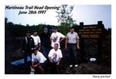
The The Martineau Trail is in the Paul Bunyan State Forest in
Hubbard County and offers several hundred miles of single
track, two track, forest roads, hills, rocks and almost
anything else you can think of. It is FREE to the public as
long as you have a current DNR ATV/Off Road Motorcycle
registration sticker, which can be obtained at your local
license bureau. There is free primitive camping at the trail
head. There are very nice accommodations nearby in the
city of Akeley at the City Park on the 11th Crow Wing Lake as
well as many hotels nearby. These are the woods were the
Akeley Enduro has been held since its conception. Akeley is
about 200 miles north of the Twin Cities.
Click Here to view a map of the
Martineau Trails.
Season
Martineau trails are open to off-highway motorcycles May 1 -
November 1
Directions & Parking
- From Walker - 10 miles west on State Highway 34 to State
Highway 64; then north 5½ miles
to Recreation Trail Marker. (Loop 1 is west of Highway 64,
Loop 2 is east of Highway 64)
- From Park Rapids - 17 miles east to Highway 64.
- From Bemidji - 28 miles south on US Highway 71, east on
State Highway 200, then south on Highway 64.
Description
Enjoy off-highway vehicle recreation at Gilbert, Minnesota.
This state recreation area provides riding opportunities for
many skill levels on varied topography and offers north woods
scenery.
Click Here to view a trail map of
the Gilbert site.
Season
May 1 - October 31 open daily 8:00 a.m. - 8:00 p.m. or one
hour before sunset, whichever is earlier.
November 1 - April 30 open Friday thru Sunday only 8:00
a.m. - one hour before sunset.
Directions & Parking
Gilbert is 200 miles north of the Twin Cities on State Highway
135.
Click Here for a printable map to
the Iron Range OHVRA.
Description
The Fort Ripley Trail and Ripley Trail Connection is a 22.9
mile ATV trail located in Crow Wing County. The trail lies
just a few miles southwest of the city of Brainerd. The Ripley
Trail is surrounded by scenic pine and oak trees.
Click Here to view a trail map of
the Fort Ripley trails.
Season
The southern section (9.5 miles) of the trail is open each
year from April 1 through November 1 for ATV's only. The
northern section (13.4 miles) is open year round to ATV's.
Directions & Parking
- From Little falls - 2 miles north on Highway 371
- From Brainerd - 1 mile south (adjacent to the Econo
Lodge).
Description
The Rabey Line ATV Trail is a 19.1 mile trail located in
Aitkin County. The trail winds through Hill River State Forest
and Savanna State Forest and is located between Hill City and
the town site of Jacobson following the old abandoned Hill
City and Western Railroad grade. The trail has a combination
of high ground, swamp/bog areas, and beautiful woods along the
Mississippi River.
Click Here for a trail map of the
Rabey Line ATV Trail.
Season
The Rabey Line Trail is open from April 1 - November 30 for
ATV use.
Directions & Parking
- From Hill City - 1 mile east on Highway 200, and at the
county campground and wayside rest at Jacobson.
- From Grand Rapids - 18 miles south on Highway 169 to
Highway 200 east, 1 mile to parking area.
- From McGregor - 30 miles north on Highway 65 to
Jacobson, ½ mile west on Highway
200.
Description
The Red Dot ATV Trail runs 27.6 miles in north eastern
Minnesota in Lake County. The trail connects the towns of
Beaver Bay and Silver Bay, and runs through the Palisade
Valley Recreation Unit of Tettegouche State Park.
Click Here for a map of the Red
Dot Trails.
Season
The trail is open to ATV's only: from May 15 - November 30.
Directions & Parking
- From Beaver Bay - Trailhead is located on the north side
of Highway 4, ½ mile west of
State Highway 61
- From Silver Bay - Off Highway 5 on the west side of
town.
Description
The Red Top ATV Trail is a 11.3 mile trail located in Aitkin
County. The trail lies off the Soo Line trail, 4.6 miles from
Isle, near Lake Mille Lacs Lake. The trail winds through a
forested area and provides a pleasant excursion for riders on
the Soo Line.
Click Here for a map of the Red
Top ATV Trail.
Season
The trail is open to ATV's only: from May 15 - November 1
Directions & Parking
The trail head lies NE on Soo Line 4.6 miles. Parking for Soo
Line and Red Top is available in Isle.
Description
The Southeast MN ATV Trail runs for 12.7 miles in Winona
County. The trail traverses a variety of terrain ranging from
rolling farmland to deep, forested ravines and valleys.
Rollingstone Creek and Garvin Brook lie along the trail.
Click Here for a map of the
Southeast MN ATV trails.
Season
The trail is open only to ATV's from May 15 to October 31.
Directions & Parking
Access off US Highway 14 near Stockton on the west side of the
trailer court.
Description
The Soo Line North ATV Trail is a 112 mile trail running
through Carlton, Aitkin and Cass Counties. The trail consists
of three main sections: from Moose Lake to Lawler, from Lawler
to Shovel Lake, and from Shovel Lake to Cass Lake. Portions of
the trail run through Savanna State Forest, Bowstring State
Forest, and Chippewa National Forest.
Click Here for a map of the Soo
Line North ATV Trail.
Season
The Soo Line North Trail is open for ATV use from April 1 -
November 30 in Cass and Aitkin Counties and on a year-round
basis in Carlton County.
Directions & Parking
Trail head is at the former rail junction ¾ of a mile
southwest of the Soo Line Deopt in Moose Lake. Parking areas
are also located in the towns of Lawler, Shovel Lake,
Palisade, McGregor, Remer and Cass Lake.
Description
The Soo Line South ATV Trail is a 114 mile trail commencing at
Saunders Junction, Wisconsin (near Superior). It runs in a
southwesterly direction through Douglas County, WI and through
Carlton, Pine, Aitkin, Mille Lacs and Morrison Counties in
Minnesota, ending in the city of Genola. This trail is
composed, in part, by the Northern Pine Riders ATV Trail, a 14
mile section located in northwest Pine County.
Click Here for a map of the Soo
Line South ATV Trails
Season
The Soo Line South Trail is open for ATV use from April 1 -
November 30 except in Morrison County, where the season ends
October 31 and Carlton County where ATV's can be used year
round.
Directions & Parking
- From Willow River - ¼ mile north on
County Road 61, 3 miles west on County Road 41, 2 miles
North on County Road 42, then 2½ miles west on County Road
52 to the Denham trail head. Parking is also available in
McGrath, Isle, on the west side of Highway 25 in Genola, and
at the Soo Line Depot in Moose Lake.
Other areas listed for OHV riding with no maps or
description currently available:
- Agassiz Recreational Trails
- Appleton Area Recreational Trails
- Blue Ox ATV Trail
- Continental Divide / Upper Willow Loop (Nemadju State
Forest)
- Elm Creek ATV Trail
- Ely ATV Trail
- Eveleth - Gilbert Connection
- Forest Riders ATV Trail / Two Inlets State Forest
- Gandy Dancer Trail / St. Croix State Forest
- Gandy Dancer Trail / Nemadji State Forest
- General C.C. Andrews State Forest
- Moose Walk / Run
- Pine Center ATV Trail
- Snake Creek Unit / Richard J. Dorer State Forest
- Soo Line ATV Trail South (Northern Pine Riders ATV
Trail)
- Soo Pits
- Spring Grove OHM Track
- Tower Multi Use Trail
- Tri County ATV Park
- Trout Valley Unit / Richard J. Dorer State Forest
- Yellow Birch - Nemadji State Forest
|